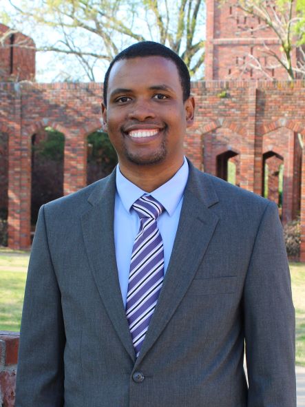
Wondimagegn Beshah
Remote Sensing
Remote
Mississippi State, MS 39762
Wondimagegn Tesfaye Beshah is a PhD Student at the Department of Geoscience, Mississippi State University. His research area is Remote Sensing of water quality. He is currently serving as a Research Assistant for U.S. Army Engineer Research and Development Center (ERDC) - Seadwag project. He has an interdisciplinary background with over 15 years of work experiences in academic institutions, private sector, NGOs, regional organizations, and international organizations. He has 12 years of web development experience and over 8 years of Geographic Information Systems (GIS) development experience. He has developed over 25 web and desktop systems. During this time, he consulted NASA and USAID led SERVIR project for nearly 2 years in which he developed 4 web mapping applications with the technical follow up from NASA. He consulted UN Habitat for over two years in which he developed a popular Land Information System named the Social Tenure Domain Model and supported projects in 10 countries in Africa and Asia. More recently, he has developed two web applications at the Mississippi State University. Wondimagegn developed a free and open source QGIS Desktop plugin that automates GPS data import. So far, the plugin has been downloaded over 40,000 times by users around the world.
Education
PhD in Earth and Atmospheric Sciences
Mississippi State University – May 2018 to Present
Master of Arts in Development Studies
Tata Institute of Social Science - Mumbai, Maharashtra - June 2008 to May 2010
Bachelor of Arts in Community Development and Leadership
Ethiopia Adventist College - October 2006 to February 2011
Bachelor of Education in Geography
Alemaya University (now Haramaya University), Alemaya, Ethiopia - October 2000 to July 2004
Research Interests
- Remote Sensing
- GIS
- Water Quality
Recent Publications
- W. Beshah, P. Dash, A. Skarke, and R.J. Moorhead (2018). An interactive map-based water quality visualization tool for the Gulf of Mexico. Presented at the Alabama Mississippi Bays and Bayous Symposium, Mobile, AL., 28-29 Nov.
- P. Dash, M. Devkota, M. S. Sankar, W. Beshah (2019). Influence of river input on the carbonate chemistry of northern Gulf of Mexico. Presented at CERF, Mobile, AL., 03-07 Nov.
- W. Beshah, P. Dash, and R.J. Moorhead (2019). Estimation of Suspended Particulate Matter Over the Henderson Point and Pass Christian Oyster Reefs, Mississippi Using Unmanned Aerial Systems Imagery. Poster presented in Mississippi Academy of Sciences, Hattiesburg, MS., 21-22 Feb.
- W. Beshah, P. Dash, L. Hathcock, R.J. Moorhead, D. Cuervo, R. Ryan (2020). https://bbs20.baysandbayous.org/br/program-schedule/program/245/living-m.... Presented at the Alabama Mississippi Bays and Bayous Symposium, 01-03 Dec.